Step Forward on Coastal Planning Controls
Published on 13 September 2021
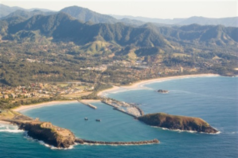
Planning controls to guide coastal development in areas affected by sea level rise, climate change and extreme weather along our local coastline have been sent to the NSW Government.
This move is the latest stage of the implementation of the Coffs Harbour Coastal Zone Management Plan.
“A huge body of work has been done on our Coastal Zone Management Plan and the next step is to have our Coastal Vulnerability Area mapping for the Coffs Harbour Local Government Area included in the NSW Government’s own State Environmental Planning Policy for Coastal Management,” said Sally Whitelaw, Council’s Team Leader Biodiversity Coastal and Flooding.
Council has an adopted Coastal Processes and Hazards Definition Study and a Coastal Zone Management Study which form the background work to the current Coffs Harbour Coastal Zone Management Plan.
One of the high priority actions contained within the Coastal Zone Management Plan is the update of local policy and planning controls to address development affected by coastal hazards.
Council began the update in 2014, but this was deferred when the NSW Government began its own coastal management reforms which has now been completed.
The Coastal Vulnerability Area mapping, and accompanying draft policy and planning controls, will now be sent to the NSW Government for permission to put it on public exhibition for community feedback.
Following the exhibition, a final draft policy and development controls will then be developed and the mapping will be sent on for insertion into the NSW Government’s own State Environmental Planning Policy.
More information on the Coastal Vulnerability Area mapping and the process can be found on the Development in the Coastal Vulnerability Area (CVA) page on Council’s Have Your Say website.